


Manipur is one of the seven states of Northeast India, and one of the Seven Sister States. The state is bounded by Nagaland in the north, by Mizoram in the south, by Assam in the west, and by the borders of the country Myanmar in the east as well as in the south. The state capital of Manipur is Imphal.The official languages of the state are Manipuri and English. The state lies at latitude of 23°83’N – 25°68’N and longitude of 93°03’E – 94°78’E. The total area covered by the state is 22,347 km². The capital lies in an oval-shaped valley of approximately 700 square miles (2,000 km2) surrounded by blue mountains and is at an elevation of 790 metres above the sea level. The slope of the valley is from north to south. The presence of the mountain ranges not only prevents the cold winds from the north from reaching the valley but also acts as a barrier to the cyclonic storms originating from the Bay of Bengal. There are four major river basins in Manipur State, the Barak River Basin (Barak Valley) to the west, the Manipur River Basin in central Manipur, the Yu River Basin in the east, and a portion of the Lanye River Basin in the north. The total water resources of Barak and Manipur river basins are about 1.8487 Mham. The overall water balance of the state amounts to 0.7236 Mham in the annual water budget.(By way of comparison, India receives 400 Mham (million hectare meters) of rain annually) The Barak river, the largest river of Manipur, originates in the Manipur Hills and is joined by a number of tributaries such as the Irang, Maku, and Tuivai. After its junction with the Tuivai, the Barak River turns north and forms the border with Assam State, and then enters the Cachar Assam just above Lakhipur. The Manipur river basin has eight major rivers: the Manipur, Imphal, Iril, Nambul, Sekmai, Chakpi, Thoubal and Khuga. All these rivers originate from the surrounding hills. Almost all the rivers in the valley area are in the mature stage and, therefore, deposit their sediment load in the Loktak lake.The rivers draining the Manipur Hills are comparatively young, due to the hilly terrain through which they flow. These rivers are corrosive in nature and assume turbulent form in the rainy season. Important rivers draining the western area include the Maku, Barak, Jiri, Irang and Leimatak. Rivers draining the eastern part of the state, the Yu River Basin, include the Chamu, Khunou and other short streams. Physiographically, Manipur may be characterised in two distinct physical regions – an outlying area of rugged hills and narrow valleys, and the inner area of flat plain, with all associated land forms. These two areas are not only distinct in respect of physical features but are also conspicuous with regard to various flora and fauna. The valley region would have been a monotonous, featureless plain but for a number of hills and mounds rising above the flat surface. The Loktak lake is an important feature of the central plain. The total area occupied by all the lakes is about 600 km². The altitude ranges from 40 m at Jiribam to 2,994 m at Mt. Iso Peak near Mao Songsong. The soil cover can be divided into two broad types, viz. the red ferruginous soil in the hill area and the alluvium in the valley. The valley soils generally contain loam, small rock fragments, sand and sandy clay, and are quite varied. On the plains, especially flood plains and deltas, the soil is quite thick. The top soil on the steep slopes is very thin. Soil on the steep hill slopes is subject to high erosion, resulting in gullies and barren rock slopes. The normal pH value ranges from 5.4 to 6.8.The climate of the State is salubrious with approximate average annual rainfall varying from 933 mm at Imphal to 2593 mm at Tamenglong. The temperature ranges from sub-zero to 36°C. The maximum temperature in the summer months is 32 degree C. In winter the temperature often falls below zero, bringing frost. Snow sometimes falls in some hilly regions due to the Western Disturbance. The coldest month is January, and the warmest July. The ideal time for tourism in the state, in terms of climate, is from October to February, when the weather remains bright and sunny without the sun being too hot.
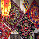
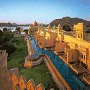
Manipur is not only the gateway to the North-Eastern Region but also a fascinating destination for discerning tourists. Legends say that discovery of Manipur is the result of the delight the God took in dancing. It is this remarkable bid that gives Manipur a unique identity of her own. Blessed with a salubrious climate, famous for its distinctive cultural pattern and its evergreen scenic beauty, extend the tourists a cordial invitation to visit Manipur. Shree Shree Govindajee Temple:This temple adjoining the palace of the former rulers of Manipur, is a historic centre for Vaisnavites. It is a simple and beautiful structure with gold domes, a paved court and a large, raised congregation hall.Shree Shree Govindji Temple the presiding deity in the centre is flanked by idols of Radha Govinda, Balaram and Krishna on one side and Jagannath, Balabhadra and Subhadra on the other. Kaina - The scared place of Hindus:29 kms. from Imphal. A beautiful hillock, about 921 m. above sea level, Kaina is a sacred place of Hindus. According to legend, Shri Govindajee appeared to His devotee Bheigyachandra, Maharaja of Manipur, in a dream and asked him to build a temple enshrined with His image carved out of a jackfruit tree which was then growing at Kaina. Beautiful hill shrubs and charming natural surroundings give the place a saintly solemnity. Ceremonial dances depicting the devine dream are performed as Ras at the Mandop. Kaina can be reached by bus via Thoubal also Accommodation Kaina Tourist Home.reserv through Director of Tourism, Khwairamband Bazaar:This is a large covered market split into two sections on both sides of the Khwairamband Road. Vegetables, fishes, household utensils & implements and fruits are sold on one side and colourful handloom shawls, phaneks, khudeis, bedsheets on the other. The market is very special in the sense that all the stall holders are women. Not far from here, is a street where beautiful cane baskets and furniture are sold. Other smaller markets are Singjamei, Kongba, Lamlong, Kwakeithel, Heirangkhoithong, Terakeithel, Naoremthong etc Manipur Zoological Garden:About 6 km. from Imphal, towards the west, in this Zoological Garden at Iroishemba on the Imphal Kangchup Road. Graceful brow-antlered deer, "Sangai" one of the rarest species in the world, can be seen here in sylvan surroundings. A trip to this garden, at the foot of the pine-growing hillocks in the westernmost corner of Lamphelpat is really enjoyable. Loktak Lake and Sendra Island:48 km. from Imphal. A huge and beautiful stretch of water, this lake is like a miniature inland sea. From the Tourist Bungalow, set atop Sendra island, visitors can get a bird's eye view of the lake and the life on it, the fisherman and their families who live in neat huts on its shores and who make full use of their watery environment. They cast their nets on it, rear fish farms in it using nets as floating walls, harvest it for the water chestnut known as Heikak, and even build their houses on the islands of floating weed that dart around the lake. There are buses and cycle rickshaws to cover the last 3 km. to Sendra War Cemetries:The British and the Indian Army Cemeteries commemorating those who died in the Second World War are serene well-maintained with little stone markers and bronze plaques recording their anguish and sacrifice. These graves are maintained by the Commonwealth War Graves Commission. Langthabal:8 km. from Imphal on the Indo-Burma Road lies this small hill feature with the relics of an old historic palace, well-planned temples and ceremonial houses amidst pine and jackfruit trees planted symmetrically. Overlooking the Manipur University, Canchipur, it offers a pleasant view of the surroundings. Moirang:45 km. from Imphal, Moirang holds an ancient temple of the pre-Hindu deity, Lord Thangjing. Every May, men and women, in gorgeous traditional costumes, sing and dance in honour of the Lord here at the Moirang Lai Haraoba. It was from the village of Moirang, too, that the graceful Khamba-Thoibi dance originated, traditionally celebrated in May. It was in Moirang that the flag of the Indian National Army was first hoisted on Indian soil on April 14, 1944. Statue of Netaji There is an INA Museum exhibiting letters, photographs, badges of ranks and other articles associated with this movement. There is also a bronze statue of Netaji in uniform. There are buses which operate from private bus station of Waheng Leikai junction to Moirang from 8 a.m. to 6 p.m. Fare: Rs. 10/- . Journey time is around 1 hr. Moreh:110 km. from Imphal. This border town is located on the Indo-Burma Road. A commercial town attracting a large number of people from neighbouring places. It is only 5 km. from Tamu town, its Burmese counterpart. Tamu depicts a total change in the attire and eating habits of the people and in the architecture of its buildings. Singda:At an altitude of 921 m., 16 km. from Imphal to the west is a hill resort on the hills overlooking Manipur Valley. The scenery is picturesque. It is also a mountain pass on the road to Tamenglong. There is an inspection Bungalow here. There is a nice artificial lake called Singda Dam. It is now a multipurpose project. Phubala: 40 km. from Imphal. A charming resort on the western fringes of the Loktak Lake, to the south of Imphal. It is joined to the mainland by a low causeway. Khongjom:36 km. from Imphal. Situated on the Indo-Burma Road, this is a place of greatest historic importance. It was here that Major General Paona Brajabashi, one of the great warriors of Manipur, proved his velour against the superior force of the invading British Army in 1891. The hillock of the foot of which he laid down his life in defence of his motherland, is reminiscent of the past heroic deeds of Manipuri warriors. A war memorial on the top of this scenic hill feature, adds charm to this heroic site. Khongjom day is celebrated as a State Holiday on every year on April 23. Sahid Minar:This tall Minar of Bir Tikendrajit Park in the heart of the capital commemorates the indomitable spirit of Manipur martyrs who sacrificed their lives while fighting against the British in 1891. Manipur State Museum:This interesting museum near the Pologround has fairly good display of Manipur's heritage and a collection of portraits of Manipur's former rulers. Items of special interest are costumes, arms and weapons, relics and historical documents. Open : 10 a.m. to 4.30 p.m. Sunday and Holidays closed. Khonghampat Orchidarium:The Orchid Yard of the Forest Department, on National Highway No 39, about 7 km. from Imphal is another place of interest. More than 110 varieties of Orchids, including several rare species, are grown here. Peak season is April-May. ANDRO - the ancient village:27 km towards east of Imphal is the ancient Scheduled Caste village of Andro, there is one Cultural Complex established by the Mutua Museum, Imphal. It consists of potteries of the North Eastern Region of India. There is a 'Doll-House' where dolls of 29 recognised tribes of Manipur (both male and female) are in display. Keibul Lamjao National Park:53 kms. from Imphal and on the fringes of Loktak Lake, this is the last natural habitat of the marsh-dwelling brow-antlered deer of Manipur called "Sangai". Sekta - Archeological Living Museum:Sekta Mound locally known as the "SEKTA KEI" is a protected Archaeological Site. The site is located at Sekta village, about 16 km. from Imphal on the Imphal-Ukhrul Road. It is a site where practice of secondary burial was discovered. The site was jointly excavated by the Archaeological Survey of India and the State Archaeology, Manipur and is preserved as a Living Museum. Mao: -Mao is one of the oldest hill stations Manipur bordering Nagaland located midway between Dimapur and Imphal on the National Highway 39 at an altitude of 5762.02 feet above sea-level. The Mao IB, built by the Royal Military engineers in 1897 is more than hundred years old. The cultural mosaic of Manipur is not complete without the colorful Mao-Naga dance. Other places worth visiting is Makhel, the historical place of Naga dispersal and the legendary places worth visiting is Makhel, the historical place of Naga dispersal and the legendary place of common origin of the Meiteis and the Nagas, which has the oldest pear tree memorial of the dispersal. Dzuko Valley with its pristine beauty blooms with a rare lily between May and July known as Dzuko Lily. Koubru Leikha :- Koubru is one of the pious mountains of Manipur and is located on NH-39. A three hundred years old temple of Lord Koubru Mahadeva is situated in the foot hills of "Awang asuppa yoimyai khunda ahanba mountain". The devotees offer rituals in the name of Koubra Baba or the Lord Shiva. In the month of Savan & Mahashiv Ratri, around twenty five thousands devotees used to come in ceremonial attires from different places to offer rituals and chant Mantras in praise of Lord Shiva. The temple is situated besides a beautiful mountain river which attracts hundreds and thousands of tourists. The temple has been maintained for the last 10 years by the Manipur Seva Kanwariya Samittee. Ukhrul: - The district headquaters of Ukhrul district is situated 83 Kms away from Imphal in the east. Undoubtedly, one of the highest hill stations of the state, Ukhrul is famous for a peculiar type of terrestrial Lily, the Siroy Lily (Lilium macklinae sealy) which is grown on the Siroy Hill. Khangkhui Lime Caves are interesting places for excursion. Ukhrul wears gay and festive appearance during Christmas. Known for the natural hospitality of its people, I is the place where pioneer missionary, William Pettigrew was first offered a foothold. Tamenglong: - It’s the district headquaters of Tamenglong district situated 156 Kms from Imphal. The region is known for its deep gorges, mysterious caves, refreshing waterfalls, exotic orchids and oranges. The Tharon Caves, Booming Meadow, Zeilad Lake and Barak waterfalls are interesting tourist spots in Tamenglong district. There’s nothing to beat the Tamenglong brand of oranges and cane-mats. Moreh: - The international border town is located on the Indo-Myanmar Road 110Kms south east of Imphal. Being a commercial town, it attracts a large number of people from away from Tamu, its Myanmarese counterpart which was of late given face lift. The recent opening of the Border Trade turned Moreh into an important commercial hub in the North-East. Right on the other side of the border, at Namphalong, there’s a big Myanmarese shopping complex selling all kinds of Thailand and Chinese consumer goods. The shopping complex serves as a poor man’s alternative to Bangkok’s National Stadium Shopping Arcade. Things come much cheaper there. Conducted Tours are organized from Moreh to Myanmarese towns like Kalimiew and Mandalay. Such a tour is of the rare opportunities. Churachandpur: - It is the second biggest town of the state spreading out on both sides of the Tiddim Road, 60Kms away from Imphal. It exhibited potteries of the North-Eastern region of India. There also is a Doll-House wherein dolls of recognized Tribes of the State are displayed.

Loktak H E Project , MANIPUR , 795124
Kendriya Vidyalaya education services in MANIPUR

(0385) 2310352
Singjamei, PO-Imphal, Dist-Imphal
United Bank of India in Imphal West, Manipur
22215
Liwa Khullen Sarai Chandel Manipur , MANIPUR
Jawahar Navodaya Vidyalaya education services in MANIPUR
Changraphung , MANIPUR , 795145
Patkai Christian Academy education services in MANIPUR
Churachandpur Tuinom Manipur , MANIPUR
Jawahar Navodaya Vidyalaya education services in MANIPUR
Bishnupur , MANIPUR , 795126
Jawahar Navodaya Vidyalaya education services in MANIPUR
Okhro- Ikhro Mao Gate Manipur , MANIPUR
Nazreth Residential School education services in MANIPUR